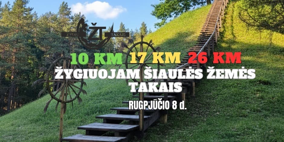
Žygiuojam Šiaulės žemės takais 2026
Buy tickets

By going on a hike in Šiauliai, you will immerse yourself in the peaceful nature of Šiauliai land - a place where forests, fields and old settlements merge into a single, living landscape. The route starts at the Šiauliai observation tower, from which a wide horizon opens, and continues along natural paths through wooded areas and more open stretches of fields. During your journey, you will reach the Kudinii Mound - a small but historically important hill, reminiscent of the times of the old Balts and allowing you to stop for a moment above the quietly breathless surroundings. Here, nature speaks in a gentle rhythm: the gently undulating terrain, the silence of the forest, the occasional traces of wildlife and the spirit of a real hike that accompanies you all the way from the tower to the mound and back.
Everyone is welcome: families, friends, colleagues and four-legged pets.
3 choices of routes:
10 km - an easy walk for families and beginners. The time to cover the track is about 3 hours.
17 km - a moderately difficult track for active hikers. The time to cover the track is about 5 hours.
26 km - For experienced people. The time to cover the track is about 7 hours.
Starting place: Šiauliai observation tower site.
Coordinates of the place: 55.64265305262417, 23.41863768382998
There will be an outdoor toilet at the starting place.
Water refills will be provided during the hike. stops.
Date: August 8, Saturday.
During the hike, you can expect:
a 10 km route that will lead you through the quiet forests and fields of Šiauliai's surroundings, connecting the two most prominent points - the Šiauliai observation tower and the Kudinii Mound, natural paths, slightly undulating terrain, wide panoramas and cozy, natural atmosphere enriched with history, suitable for both a quiet walk and a rhythmic hike. The time to cover the track is about 3 hours. Road surface: forest roads, public roads. There will also be open fields. 1 water stop is expected.
The 17 km route that winds through the quiet land of Šiauliai, where natural unpaved paths lead through forests, fields and slightly undulating terrain with ~140 m ascents, allowing you to enjoy wide panoramas and constantly changing surroundings, is a hike of moderate difficulty, suitable for well-prepared participants looking for a longer, rhythmic and nature-enriched route. The time to cover the track is about 5 hours. Road surface: forest roads, public roads. There will also be open fields. 2 water stops are planned.
This 26 km route stretches through the wide spaces of Šiauliai land, where more than 21 km consist of unpaved, natural paths leading through forests, fields and remote areas, the terrain is undulating, with ~180 m ascents, so the hike requires good physical fitness, but is rewarded with silence, wide panoramas and true, from a sense of nature far from civilization, which keeps the rhythm from the first to the last kilometer. The time to cover the track is about 7 hours. Road surface: forest roads, public roads. There will also be open fields. 3 water stops are expected.
The routes will be marked with arrows.
The 10 km track will be marked with a green arrow.
The 17 km track will be marked with a yellow arrow.
The 26 km track will be marked with a red arrow.
It is recommended for everyone to have an app through which you can open a gpx file. One of the available apps is "Komoot". You can also try other apps, type gpx in the google play store and it will give you a list of apps.
Once you pay for the hike, you will receive a route map by email immediately. A gpx file and a link to the map will be attached.
Place registration
10 km hikers will be able to arrive and register from: 9:00 - 11:00
17 km hikers can arrive and register from: 9:00 - 10:30
28 km hikers can arrive and register from: 9:00 - 10:00
Registration:
You can register by purchasing tickets.
Clothes: Choose according to the weather conditions. You won't need to wade through the swamps, you will hike on forest tracks, roads.
Prices:
10 km route
Normal price: 10 €
For pupils and students: 7 €
For seniors: 8 €
Free for children under 6.
17 km track
Regular price: €14
School and student: €10
Seniors: €11
Free for children under 6.
26 km route
Normal price: €17
For pupils and students: €13
For seniors: 14 €
Free for children under 6 years old.
Ticket prices will increase a week before and the day after the event.
Payment in cash will not be possible on the day of the hike.
Pre-registration is required. If you know you won't be able to come, be sure to let us know. After purchasing the ticket, the money is not refundable except upon arrival.
After the hike, you will receive wonderful medals and optional laminated diplomas or e-mails. diplomas.
You will receive a starting basket at the starting point. There you will find water and snacks.
There will be water stops during the hike.
When hiking more kilometers, we recommend having patches, chafing ointment, and mosquito spray.
Tickets for the hike can be purchased during registration.
Each participant is responsible for his own health and belongings. safety.
See you at the hiking site.
On the AllEvents portal you can always Buy tickets to an event Sport Žygiuojam Šiaulės žemės takais 2026, Radviliškio rajono savivaldybė, Šiaulės kalno apžvalgos bokštas August 08
* The description translation is done automatically. There may be inaccuracies. Be sure to check the event description on the ticket store website when buying tickets.
To a concert together? We'll find travel companions quickly!
Can't go to the event? Sell your ticket and save money!
Events and tickets Radviliškio rajono savivaldybė, All venues
Most popular events All Lithuania
shownet
Camouflage Live 2026 | Vilnius
allevents
Andrius Mamontovas su grupe „Geriausios dainos. I dalis“
kakava
Lietuvos vyrų krepšinio rinktinės kontrolinės rungtynės: Lietuva - Estija
paysera
PROCESŲ VALDYMO KONFERENCIJA 2026
bilietai
Pitbull - I'm Back!
bilietai
Natalija Bunkė Vasaros terasa
bilietai
SEL 50 | Kaunas 2026
bilietai
Placebo | 30th Anniversary tour
bilietai
BI-2
manobilietas
Marijonas Mikutavičius 360 / ŽALGIRIO ARENA
kakava
PVŠ ROAST OF ARŪNAS VALINSKAS
paysera
Neapleisti Garsai '26
 AllEvents.lt
info@allevents.lt
© 2023 - 2026, All rights reserved
AllEvents.lt
info@allevents.lt
© 2023 - 2026, All rights reserved